|
|


|
Free camping and campgrounds.
|
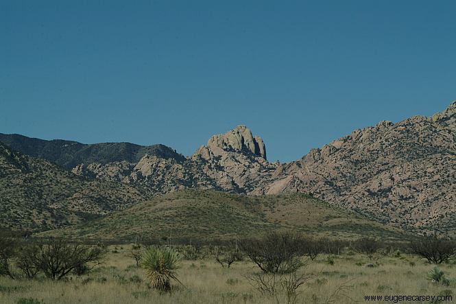
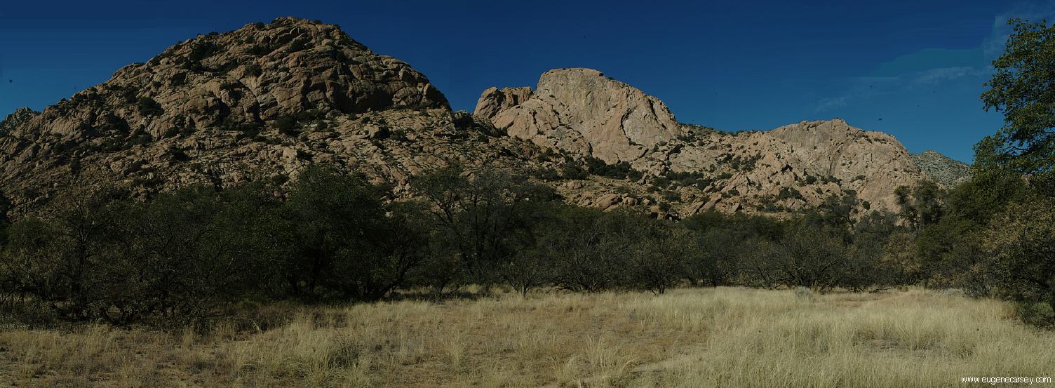
There is an established campground that cost Cochise Stronghold is located in the The sun rises extra early on this side
$10 per night, but unknown to most visitors
there are campsites all along the base of the
Cochise Stronghold that are free and much
more interesting. Cochise Stronghold is very
deceptive, looks like a simple rock but it is a
complex maze. As you start to get up close
and personal with these rocks, your imagination
starts to run wild...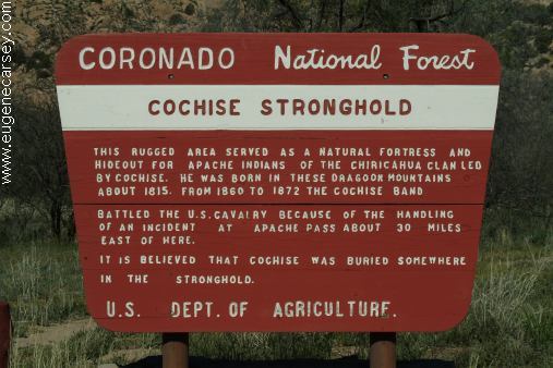
This rugged area served as a natural fortress and
hideout for Apache Indians of the Chiricahua Clan
led by Cochise. He was born in the Dragoon Mountains
about 1815. From 1860 to 1872 the Cochise Band
battled the U.S.Cavalry because of the handling
of an incident at Apache Pass about 30 miles east
of here. It is believed that Cochise was buried some-
where in the Stronghold
Dragoon Mountains.
of the mountains. Best photos are in
the morning.
Deer and wildlife are common sights. The photos show trees and vegetation, After entering National Forest Lands, DIRECTIONS: NOTE: MORE DIRECTIONS: The free camping areas are just after you Turn right on Road 84A or 84B. Water at Cochise Campground FIRE RESTRICTIONS Camped here 2004 Also see: COCHISE STRONGHOLD WEST RATTLESNAKE
RANCH
Cochise Stronghold, Road 84A
Also be aware of rattle snakes, scorpions,
killer bees and fire ants to name a few
dangerous critters you might stumble
upon. Boots are recommended.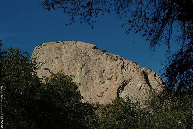
The first camp on Road 84A
N 31°56.600
W 109°57.525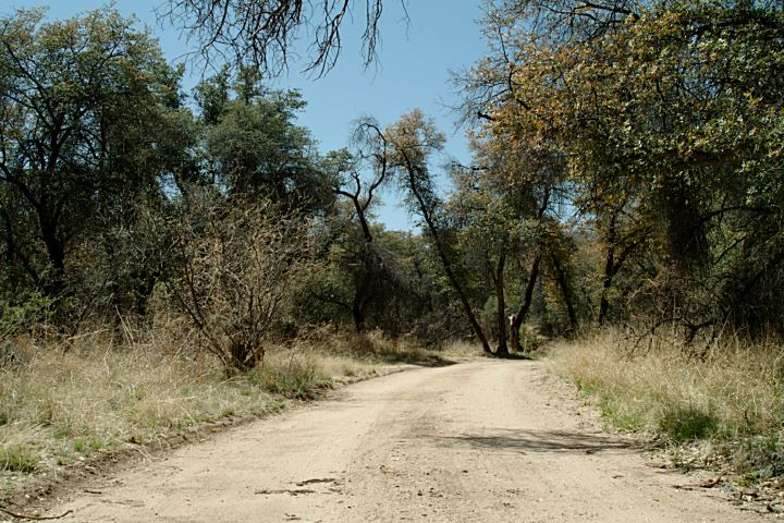
Road 84A
but it is a desert environment.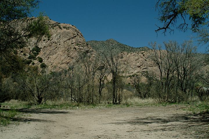
Camp and Trailhead on the first road...
N 31°56.745
W 109°57.554
turn right on the first road (Near the sign
and garbage cans). There is a camp and
trailhead a short distance. If you continue
towards the end of this road, it gets rougher,
with more obstacles, but there is a great
campsite... no photos at present time.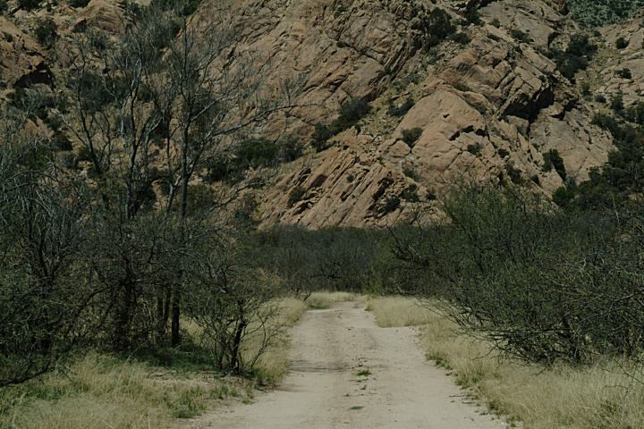
Road towards the camp on the first road...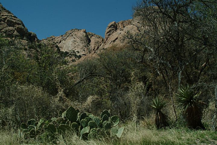
Views from the camp on the first road...
Hwy.191 at Sunsites
At the north end of town near milepost#49
Turn west at Ironwood Road
(at Hooligans Gas Station)
There is a sign pointing to Cochise Stronghold
and you can see the towering mountains of
rock in the distance. From Ironwood Road
it is 5 miles paved surface, then 2 miles of
maintained dirt road. 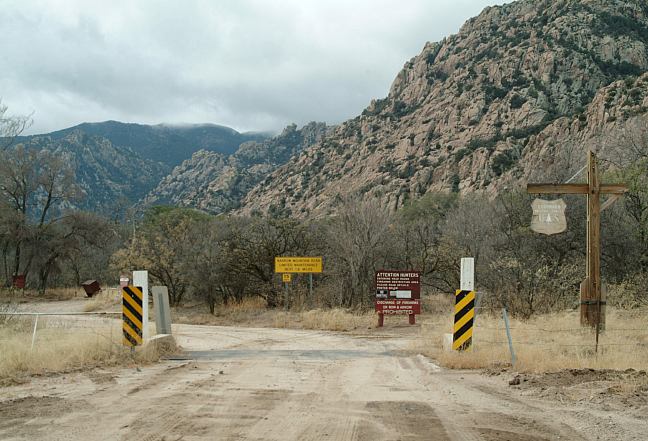
Entrance to Coronado National Forest
Can be difficult to find at night, even if you
have been here before.
• Ironwood Road is at the north side of Sunsites
• 7 miles south of the Apache Power Plant.
• 60 miles from Bisbee via Elfrida.
enter Coronado National Forest. You will
see a "No Hunting" sign and the sign in
above photo.
The roads wind through the trees
and along the mountain base. There
are some great camping spots.
Road 84C splits off from 84B,
with more camping areas.
(During the summer months)
Filtered water at the car wash
on Justin Road in Sunsites.
It is your responsibility to know what fire
restrictions are in effect. A shovel, ax, and
5 gallons of water may be required. Leather
gloves and fire extinguisher recommended.
Camped here 2005
Camped here 2006
Camped here 2007
Camped here March 3, 2009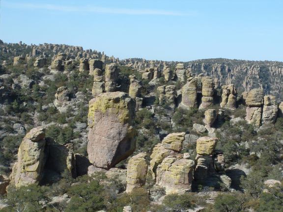
Chiricahua National Monument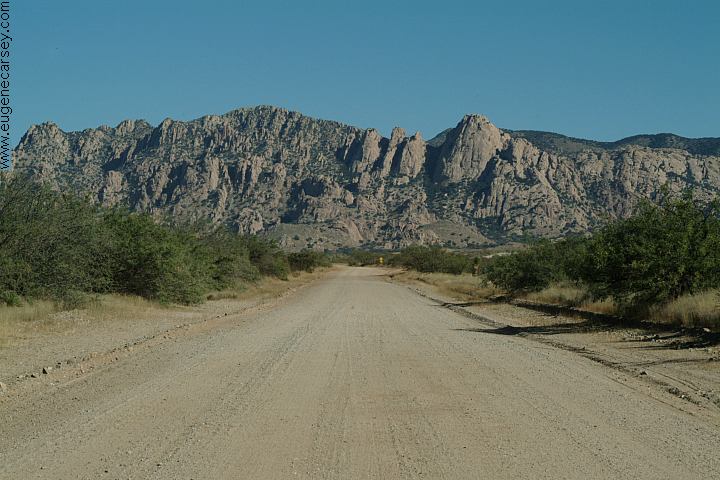
Middle March Road towards West Cochise Stronghold
Also see: CHIRICAHUA
NATIONAL MONUMENT
Also see: MESCAL
Also see: TURKEY
CREEK ROAD
Also see: WHITEWATER DRAW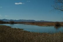
Whitewater Draw on Central Highway
Between Elfrida and Bisbee.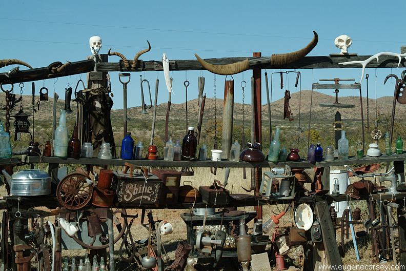
Rattlesnake Ranch
We expected a pit full of rattlesnakes and
some crazy person... instead we found a
museum in the middle of the desert.
CAMPGROUND INDEX
dispersedcampgrounds.com
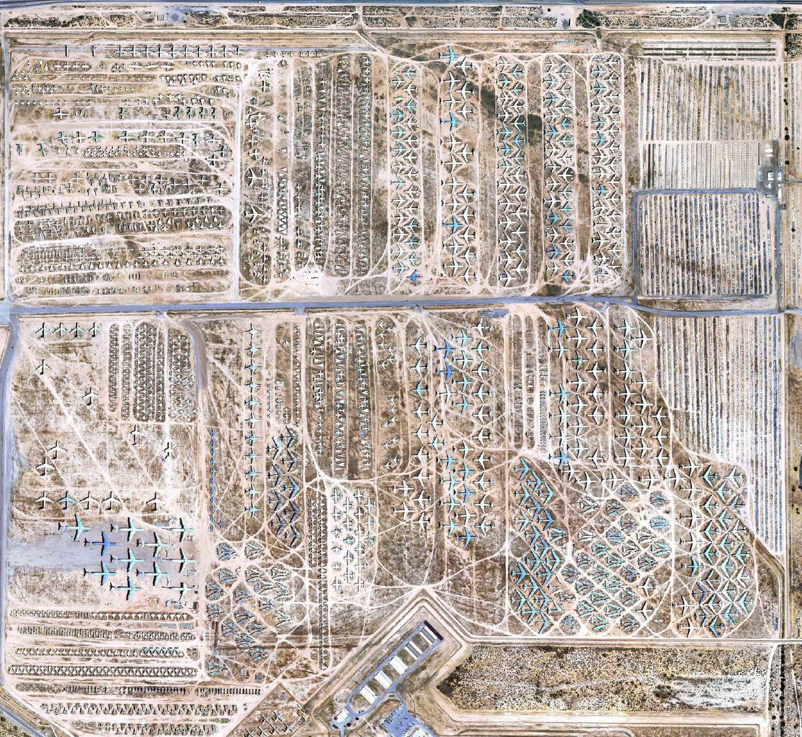
The Boneyard
Davis-Monthan Air Force Base is home
to thousands of outdated planes and helicopters
mothballed by the United States Air Force and
other allied forces. The 2,600 acre facility is the
size of 1,300 football pitches and sprawled across
the desert in Tucson, Arizona and houses the 309th
Aerospace Maintenance and Regeneration Group
(AMARG) This 60 year-old facility is America's
only storehouse for out-of-service aircraft.
Complete free campground listing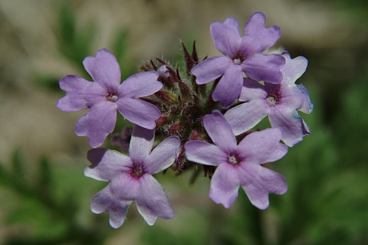
Tiny Flowers at Cochise Stronghold
Free campgrounds and camping
ARIZONA CAMPGROUND DIRECTORY
CORONADO NATIONAL FOREST
COCHISE STRONGHOLD NATIONAL MONUMENT
