|
PHOTO HERE
Old Logging Equipment on Gates Hill Road
DIRECTIONS:
From Gates, OR
Take Gates Hill Road for 3 1/2 miles
(Narrow, curves, and steep grades)
Turn right on North Fork Road
ROAD CONDITIONS
Mostly rough and rugged graveled roads
RVs not recommended
MAP
These are our personal hand drawn maps
Not guaranteed for accuracy
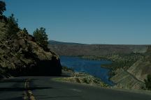
Lake Billy Chinook
Also see: DETROIT LAKE
Also see: GREEN PETER LAKE
Also see: HAYSTACK
RESERVOIR
Also see: LAKE BILLY CHINOOK
Also see: OLALLIE
SCENIC AREA
Also see: ROAD#46
Also see: ROUND
LAKE

Google Custom Map by Ian
OREGON FREE CAMPGROUND MAP
Google custom map by Ian with most of the
free campgrounds in Oregon.
CAMPGROUND INDEX
Complete free campground listing
CAMPING ADVICE AND TIPS
TOURIST
PHOTOS

www.eugenecarsey.com
dispersedcampgrounds.com
Free camping and campgrounds
OREGON CAMPGROUND DIRECTORY
WILLAMETTE NATIONAL FOREST
OPAL CREEK SCENIC REC. AREA
|


