|
|


|
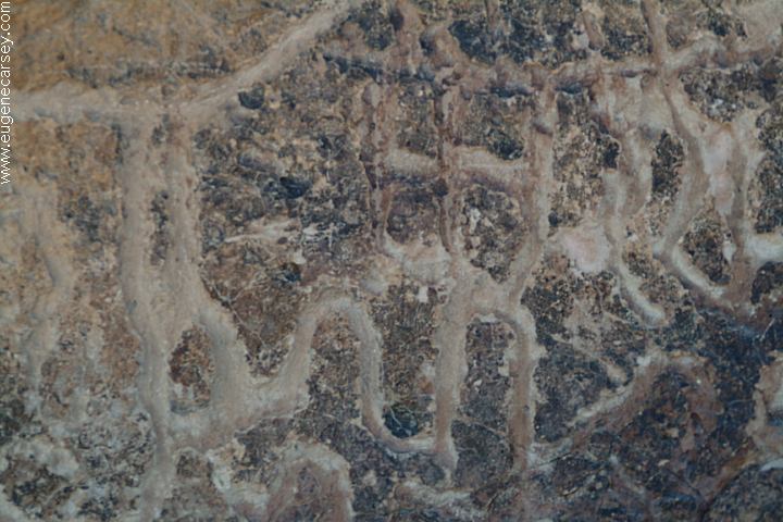
Free camping and campgrounds Don't understand what the petroglyphs mean, |
Picnic Tables Bring your own water. PHOTO HERE HICKISON SUMMIT
Hickison Petroglyphs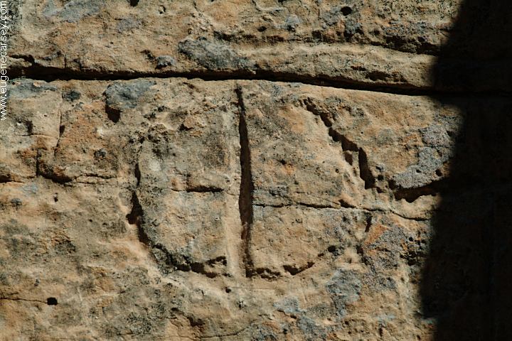
Hickison Petroglyphs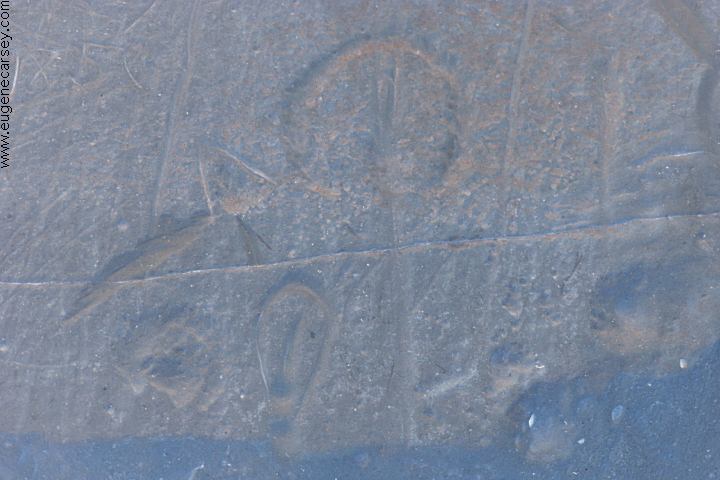
Hickison Petroglyphs
Hickison Petroglyphs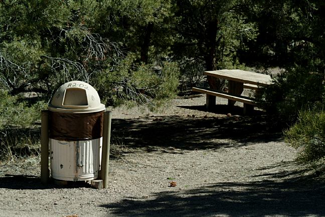
Hickison Petroglyphs Campground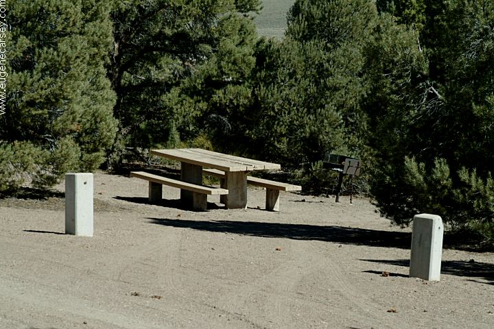
Hickison Petroglyphs Campground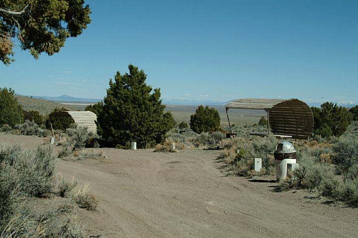
Hickison Petroglyphs Campground
BBQ Grills
Metal Firerings
Vaulted Toilets
Garbage Service
Shade Ramadas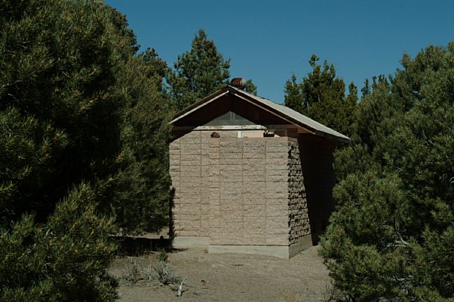
Hickison Petroglyphs Campground
We don't know the actual name of this arch.
The rock is covered with petroglyphs.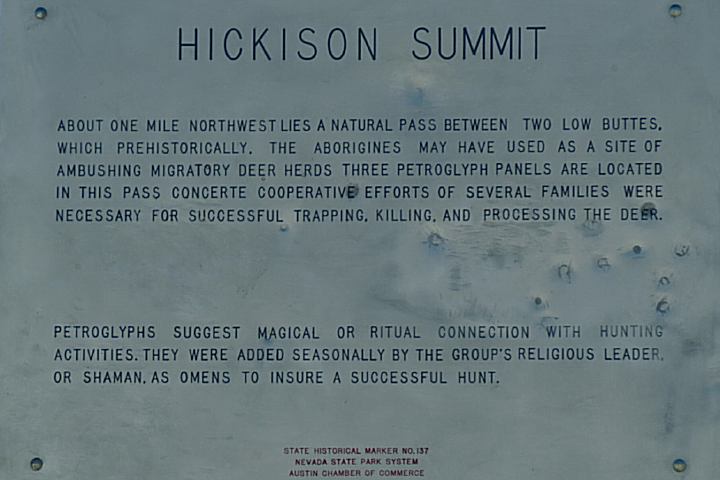
Hickison Summit
About one mile northeast lies a natural pass
between two low buttes, which prehistorically,
the Aborigines may have used as a site of
ambushing migratory deer herds. Three
petroglyph panels are located in the pass
concerted cooperative efforts of several families
were necessary for successful trapping, killing,
and processing the deer.
Petroglyphs suggest magical or ritual connection
with hunting activities. They were added seasonally
by the group's religious leader, or Shaman, as
omens to insure a successful hunt.
State Historical Marker NO#137
Nevada State park System
Austin Chamber of Commerce
DIRECTIONS: Bureau of Land Management Also see: GREAT BASIN PHOTO HERE PHOTO HERE PHOTO HERE CAMPGROUND INDEX Camped here 2003 dispersedcampgrounds.com
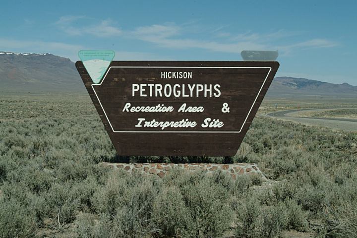
Sign on Highway 50 for Hickison Petroglyphs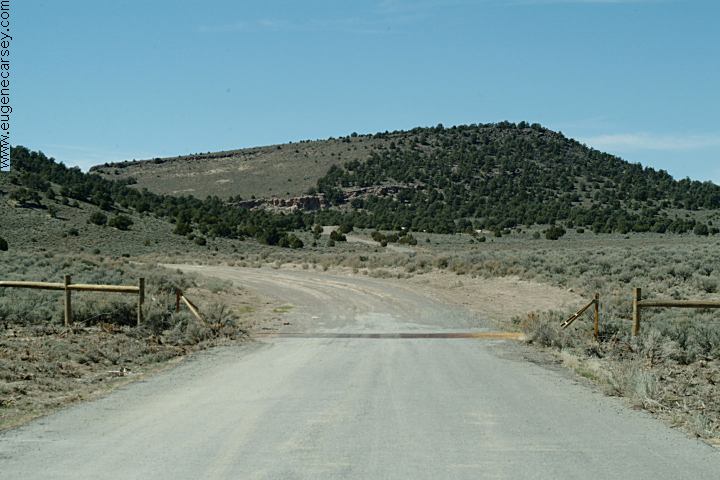
Road towards Hickison Petroglyphs
Highway.50
(The Loneliest Road in America)
xx miles east of Junction of Hwy. 376
24 miles east from Austin, NV
xx miles west of Eureka
(Between Austin and Eureka)
There is a big sign marking the turn
for Hickison Petroglyphs.
1 mile on maintained dirt road
Also see: HIGHWAY
722
Also see: WALKER
LAKE
Also see: WILSON
CANYON
Natural Arch on Hwy.50
Apx. 4'x2' opening
Shoe Tree on Highway 50
About 50 miles east from Fallon, NV
N 39°17.655'
W 117°59.196'
March 18, 2007
Tree covered with shoes.
Hwy.95 about 40 miles south of Fallon, NV
This tree was cut down our last trip on Hwy.95
March 19, 2007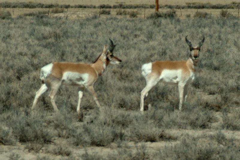
Highway 722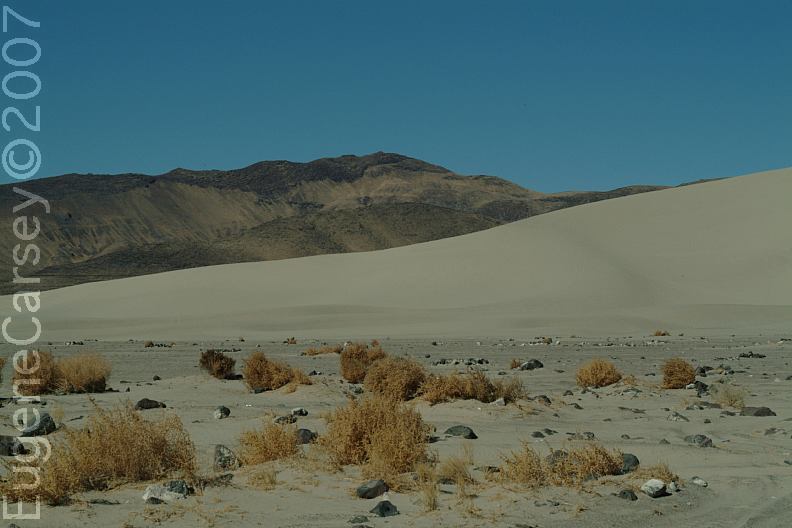
Sand Mountain Recreation Area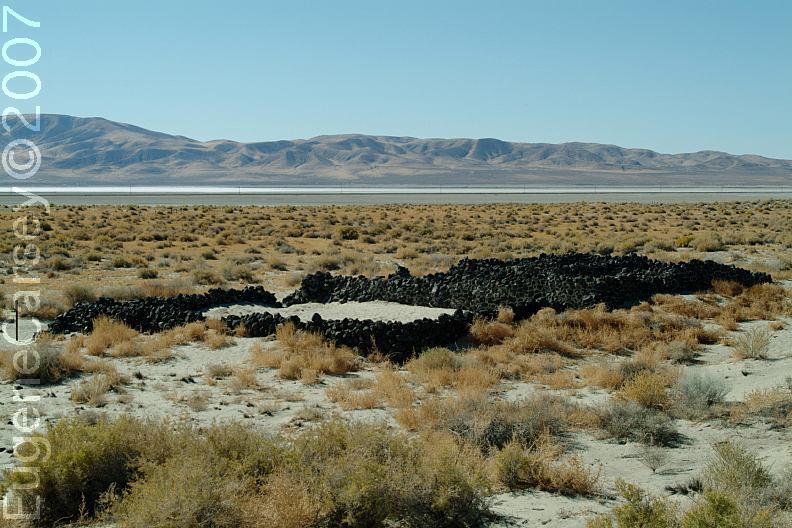
Sand Mountain Pony Express Station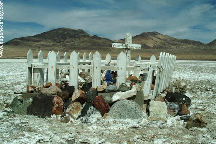
Wilson Turner 3YRS 1864
Hwy.50 near Sand Mountain
LATITUDE: N 39°17.488
LONGITUDE: W 118°26.868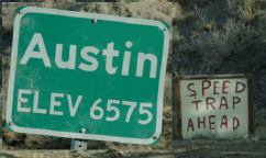
Austin, Nevada
"Speed Trap Ahead"
Complete free campground listing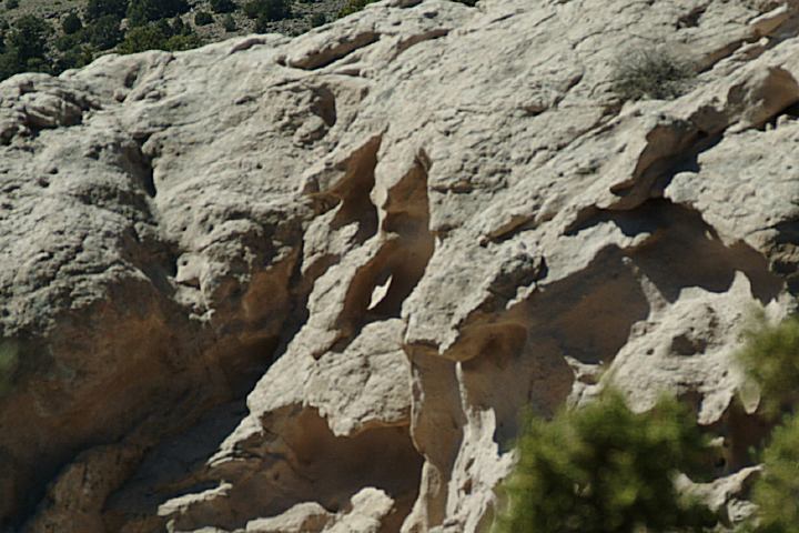
Little Arch
Camped here 2004
Camped here 2005
Camped here March 18, 2007
Free campgrounds and camping
NEVADA CAMPGROUND DIRECTORY
HICKISON PETROGLYPHS
