|
DIRECTIONS:
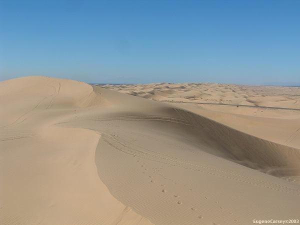
From Glamis and Imperial Sand Dunes
Hwy. 78 north and take the second road
Two big tires mark the road and say "BULL"
Campsites throughout the desert
There is a back road through the desert that
connects to Hwy.111 at Niland. There are
areas of soft sand and not recommended
for passenger vehicles.
DISTANCE FROM GLAMIS:
|
Palo Verde
Blythe
Imperial Sand Dunes
Osbourne Scenic Overlook
|
40 miles
60 miles
1 mile
2-3 miles
|
TOURIST ATTRACTIONS:
- Imperial Sand Dunes BLM Rec. Area
- Osbourne Scenic Overlook
- Misquite Mine Overlook
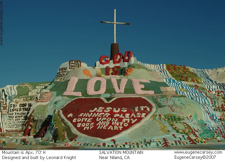
- Salvation Mountain
Bring some acrylic paint as a donation
While in the area maybe you should rent
a dune buggy.
There is a check point at the
junction of
Hwy.78 and 86 going north.
Also see: ALAMO LAKE
Also see: BETTY'S KITCHEN
Also see: BLAIR VALLEY
Also see: BOX CANYON
Also see: CARRIZO BADLANDS
Also see: CHOCOLATE MOUNTAINS
Also see: COLORADO
RIVER / CIBOLA
Also see: CRYSTAL
HILL
Also see: DOME
ROCK MOUNTAIN
Also see: GLAMIS
Also see: MESCAL
Also see: NEEDLE MOUNTAINS
Also see: ORGAN
PIPE CACTUS
Also see: PAINTED CANYON
Also see: PALM
CANYON
Also see: PALO
VERDE
Also see: PLOMOSA
ROAD
Also see: SCADDAN
WASH
Also see: SLAB CITY
Also see: SONORAN
DESERT
Also see: TRONA
PINNACLES
Also see: WAGON WHEEL
Also camping at NUDE WASH Primitive
Campground. Hwy 78, 10 miles west of
Ocotillo Wells. About 1/4 mile of dirt roads
with camping areas. Part of Anza-Borrego
State Park.
Showers at Ocotillo Wells SVRA
Off Road Vehicle Recreation Area
Hwy.78 west of Ocotillo Wells
Cost $.50
Shower between Niland and Slab City
Showers at Slab City near Niland
See: SLAB
CITY
Best spring water at BAY TREE SPRING
Hwy 243 (Between Grandview Ranger Station
and Lake Fulmor)
Purified water at Borrego Springs/ Road S2
Drinking water at Tamarisk Grove Campground/ Road S3
|