|
|


|
Free camping and campgrounds. |
|
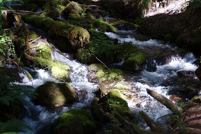
INDIGO SPRINGS CAMPGROUND
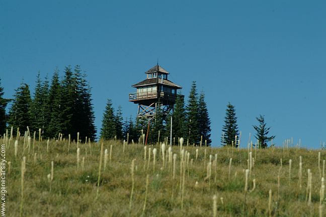
WARNER RIDGE LOOKOUT
ESTABLISHED CAMPGROUNDS HILL CREEK LAKE LEMOLO LAKE |
DIRECTIONS: Road#21 is not maintained for snow and ice. From the junction of NF Road #23 and #21 Packard Creek 5 Saw a bear on Road#21 near Indigo Cheapest gas is in Springfield near I-5 Also see: AUFDERHEIDE
FOREST DRIVE OREGON FREE CAMPGROUND MAP HILLS CREEK DAM CAMPGROUND INDEX Camped here 2006 dispersedcampgrounds.com Free campgrounds and camping
About 2 miles east of Oakridge on Hwy.58
Turn south on NF Road#23.
There is an information board about 1/8 mile
The Junction of NF Road#21 is 1/2 miles.
Continue on Road#21 about 29 miles...
Sand Prairie
Secret
Campers Flat
Sacandaga
Indigo Springs
12
18
20
25
29
Springs Campground in August 2006.
He was crossing the road and ran away.
Cheapest gas on I-5 southbound at Creswell
or I-5 northbound at Eugene, Albany or Salem.
Also see: FALL
CREEK LAKE
Also see: HILL CREEK LAKE
Also see: LAVA
FLOW CAMPGROUND
Also see: LEMOLO
LAKE
Also see: LOGGERS
BUTTE CAMP
Also see: SALMON CREEK ROAD
Also see: SCAREDMAN
BLM REC.SITE
Google Custom Map by Ian
Google custom map by Ian with most of the
free campgrounds in Oregon.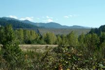
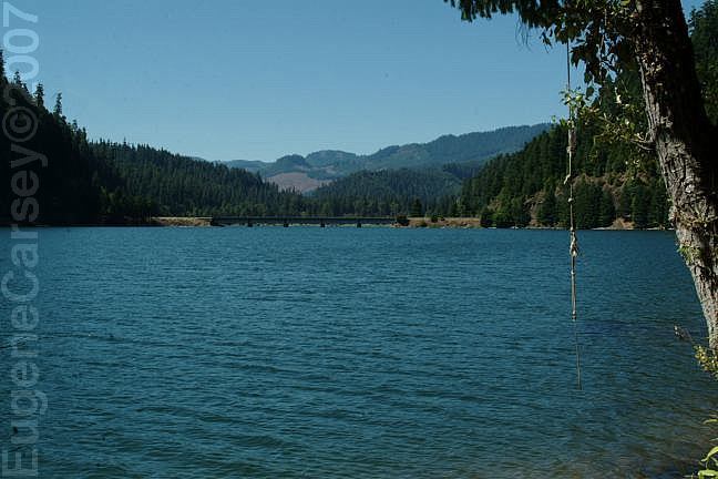
Hills Creek Dam
Photo from Road #23
(About 1/2 mile from the Jct. of Road#21)
LATITUDE: N 43°42.425
LONGITUDE: W 122°25.717
(GPS from top of Hills Creek Dam)
Hills Creek Dam and Reservoir near Oakridge, OR.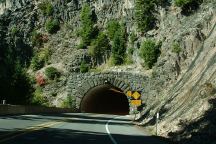
Tunnel on Hyw.58 / MP56-57
Just west from Salt Creek Falls.
Photo through windshield of vehicle at 55 mph.
Complete free campground listing
OREGON CAMPGROUND DIRECTORY
WILLAMETTE NATIONAL FOREST
INDIGO SPRINGS CAMPGROUND
