http://www.dispersedcampgrounds.comhttp://www.eugenecarsey.com

Free camping and campgrounds
OREGON CAMPGROUND DIRECTORY
OCHOCO NATIONAL FOREST
ELKHORN CAMPGROUND
DOUBLE CABIN CAMPGROUND
LATITUDE: N xx°xx.xxx
LONGITUDE: W xx°xx.xxx
Dispersed and Primitive Camping

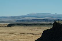
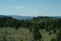
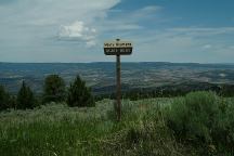
Road16 View
Road#16 View

Road#16 in Ochoco National Forest
Cows rule the road and forest. Cow
manure almost every step in some
places... good for the ranchers, a
nightmare to the environmentalists

Elkhorn Campground
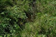
Elkhorn Campground Stream

Elkhorn Campground
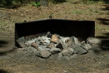
Elkhorn Camp

ELKHORN CAMPGROUND
Established campground with babbling brook.
Cattle guard protects the campground.
Picnic tables, metal firerings, and outhouse.
No garbage service
14 Day Camping Limit

Maury Mountain Agate Beds

MAURY MOUNTAIN AGATE BEDS
Almost the opposite side of Road#16 from
Elkhorn campground is Road#1680 towards
Maury Mountain Agate Beds. There are some
primitive sites along the road. On Road#1690
near Maury Mountain Agate Beds is a nice
camp and you can search for agates.

DOUBLE CABIN CAMPGROUND
Established campground
Cattle guard protects the campground.
About a 1/4 mile rough road to campground.

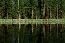
Double Cabin Pond
Double Cabin Pond

On Road#16
(Opposite of Double Cabin Campground)
There is a primitive campsite near Double Cabin Pond.
Includes a picnic table... great campsite, but you have
to deal with cow manure.

Road#17 towards Antelope Reservoir there are a
couple primitive camp areas. Not the best in the world...

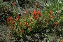
Wildflowers on Road#1690
Wildflowers on Road#1690 (July 2006)

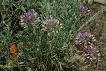
Wildflowers on Road#1690
Wildflowers on Road#1690 (July 2006)

MORE ESTABLISHED CAMPGROUNDS
ANTELOPE RESERVOIR AND CAMPGROUND
Hand water pump. Offers the basic amenities / $8.00
The campground was empty on Saturday night in the middle of July. There were a couple campers at primitive sites near the entrance on Road#17

DIRECTIONS:
From Prineville take Highway 380 east
Turn on Road#16 (Past milepost 26)
You can also enter from the east
Continue on Highway 380
Turn between milepost 30-31
From Brothers
Turn on Camp Creek Road
Follow signs to Antelope Reservoir

ROAD CONDITIONS:
Narrow dirt surface roads...

Showers at Ochoco Lake County Park
Highway 26 / Milepost 26
Non-Camper Shower $3.50

Showers at Prineville Reservoir State Park
$2.00 per person

Also see: BROADWAY LAVA FIELD
Also see:
MAYFIELD POND
Also see:
MILLICAN OHV
Also see:
NORTH SHORE ROAD
Also see:
OCHOCO NF / COTTONWOOD
Also see:
OCHOCO NF / ROAD#27
Also see:
PINE MOUNTAIN OBSERVATORY
Also see:
SALT CREEK ROAD
Also see:
STEENS MOUNTAIN
Also see:
SUCCOR CREEK

Google Custom Map Free Oregon Campgrounds
Google Custom Map by Ian

OREGON FREE CAMPGROUND MAP
Google custom map by Ian with most of the
free campgrounds in Oregon
.

Steins Pillar near Prineville

Buena Vista
Steens Mountain in the distance
From Hwy.205 at Buena Vista Viewpoint
STEENS MOUNTAIN

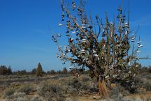
Tree covered with shoes on SW Reservoir Road

Tree covered with shoes on SW Reservoir Road

SHOE TREE
LATITUDE: N 44°04.484
LONGITUDE: W 120°56.963
SW Reservoir Road / MP 10
3 1/2 miles past Alfalfa Store
Near Willard Road and Alfalfa Curves

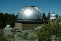
Pine Mountain Observatory

PINE MOUNTAIN OBSERVATORY

Millican
Millican
We have bought gas here in the past,
now is Millican is becoming a Ghost Town.
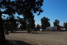
Four Corners Staging Area 
Millican Valley OHV
Four Corners Staging Area

MILLICAN VALLEY OHV AREA
LATITUDE: N 44°03.777
LONGITUDE: W 120°54.545

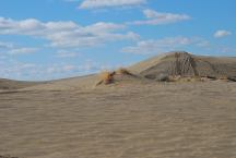
Christmas Valley Sand Dunes

CHRISTMAS VALLEY SAND DUNES
LATITUDE: N 43°21.184
LONGITUDE: W 120°23.160
Elevation: 4300'

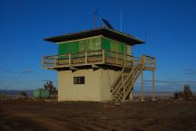
Green Mountain Lookout

GREEN MOUNTAIN CAMPGROUND
LATITUDE: N 43°23.160
LONGITUDE: W 120°43.370
Elevation: 5160'

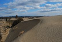
Christmas Valley Sand Dunes

CHRISTMAS VALLEY SAND DUNES
LATITUDE: N 43°21.184
LONGITUDE: W 120°23.160
Elevation: 4300'
(GPS from Junipers Camp Information Board)
Christmas Valley Sand Dunes are only a couple
miles from Green Mountain.. There are dispersed
and primitive camping areas.

EAST FORT ROCK OHV TRAIL SYSTEM
West from Pine Mountain Observatory.
Camping is permitted at all the trailheads
and staging areas, as well as any existing
dispersed camps.
CAMP II TRAILHEAD
ROAD 25 STAGING AREA
CHINA HAT CAMPGROUND
ROAD 2510 STAGING AREA
SOUTH LAVA TRAILHEAD
SAND SPRINGS

CAMPGROUND INDEX
Complete free campground listing

CAMPING ADVICE AND TIPS

TOURIST PHOTOS


Chemtrails of the USA
What are all those funny clouds in the sky...
Every day from morning to night, continuous
aerial spraying.

Camped here July 8, 2006

Copyright Notice
www.eugenecarsey.com

dispersedcampgrounds.com
Free campgrounds and camping
OREGON CAMPGROUND DIRECTORY
OCHOCO NATIONAL FOREST
ELKHORN CAMPGROUND
DOUBLE CABIN CAMPGROUND